
AIDSVu adds city maps to its online trove
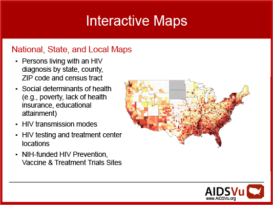
AIDSVu, the most detailed publicly available view of HIV prevalence in the United States, now includes maps for 20 U.S. cities. Launched in 2011, AIDSVu is a compilation of online maps that show the most recent HIV prevalence data at national, state, and local levels and demographics, including age, race, and gender.
The national map, for example, shows significantly higher rates of people living with HIV in the Northeast and the South than in much of the rest of the country. Viewing HIV prevalence by race or ethnicity shows that HIV disproportionately affects black and Hispanic Americans and that these disparities exist in major urban and rural areas.
AIDSVu also includes city snapshots displaying HIV prevalence alongside various social determinants of health, such as poverty, lack of health insurance, and education attainment.
"Knowing the areas most affected by HIV is critical for meeting the goals of the National HIV/AIDS Strategy, which calls for significantly reducing new HIV infections and improving care for people living with HIV," says Patrick Sullivan, professor of epidemiology. Currently, more than 1 million Americans are living with HIV, and an estimated one in five people with HIV do not know their status.
Sullivan heads up the site, which features data from the CDC. Financial support for AIDSVu is provided by Gilead Sciences. To learn more, visit aidsvu.org.
Related Links
Story: "AIDSVu releases new maps that depict impact of HIV in America"